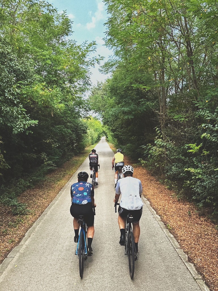
 by Peter Illés on February 2nd, 2026
Poiana Stampei is where Bucovina ends and you enter Transylvania. In the highlands, you still get proper climbs and a few rugged sections, but the rhythm is different. Longer valleys, more rolling terrain, and less of the push-bike sections that Bucovina can throw at you. Instead of just wanting to get a quick shower and fall asleep, you’ll still have enough in the tank to enjoy a slow dinner.
The Highlands Region also takes you past Piatra Fântânele, where Tășuleasa Social is based. If you want a quick sense of where Via Transilvanica came from and connect the route to the people behind it, this is the place.
In this post I’m following the official Via Transilvanica Cyclist’s Guide through The Highland Region. Same format as Bucovina: a continuous ride story with short notes on surfaces, key sights, and alternatives when you want an easier day than the official route suggests.
Stage 5. / Poiana Stampei to Piatra Fântânele
You start with a gentle 4.5km climb out of Poiana Stampei. Follow the signs to Teșna or Tătaru. First, you ride on a concrete slab road, which quickly morphs into a brand new asphalt road until the top of the climb in Tătaru, where it just as quickly turns into gravel. Descend on gravel until you see railroad tracks.
Here, you will have a chance to visit the Teșna Împuțită (the “Stinking Bog”). It’s an unusual natural landmark. You’ll have to leave your bike for a while to walk to the center of the bog and admire the unique flora and majestic pines growing in the marshes. If you liked the Tinovul Mare in Poiana Stampei, you’ll also enjoy spending time here.
From here, cross the railroad tracks before reaching the Grădinița train station and follow the forest road on the right side of the tracks. After 1 km the route turns left and starts descending toward the next village. The descent is short, but technical, especially after rain. You pass under a viaduct and turn right onto a gravel road that takes you into Lunca Ilvei. The viaduct is part of the Ilva Mică to Vatra Dornei railway, an ambitious project that connects Transylvania and Bucovina. This meandering section has 9 tunnels, 22 bridges, and 12 viaducts.
Enter the village and follow the roads until the second intersection on the right. Fifty meters after the intersection with Strada Izvoarelor, there’s a house that hosts the local Jehova’s Witnesses’ meetings. Turn left onto a gravel road immediately after this house.
Cross the stream on the small wooden bridge and prepare yourself for a 3 km climb that feels a lot longer. I promise you, it’s the biggest climb in the Highland region. You’ll probably end up pushing your bike, but this will allow you to stop and look back at the fantastic view of the Ilva Valley and the Rodnei Mountains in the background.
Near the top of the climb, you will find the official VT route marker, number 143. This is a special marker, as the stone has a bunch of holes where you can attach a lock as a sign of your passage. Follow the ridge for 2 km, until you reach Poiana Cătunenilor. You’ll know you’re there because a couple of homes will appear and the route takes a big left hairpin turn.
It’s up and down on gravel roads for the next 15 km. You’ll pass the hamlet of Ciosa and several springs where you can fill up your bottles. The road turns into asphalt. Follow it for 1 km and then turn right at the monument with the big iron cross on the top. After about half a kilometer, you will reach Tășuleasa Social, the headquarters of the NGO that created Via Transilvanica. If you wish, you’ll also find accommodation here.
Length: 35 km Elevation: 920 m Duration: 5 hours
Alternative route #1
The official guide book offers an alternative route from Lunca Ilvei. As you enter the village, immediately take the first left turn. Follow the asphalt road for about 1 km, then turn left onto a gravel climb. This climb is perhaps a touch gentler than the one on the original route, but you may still need to push your bike in some places, especially since some sections have large rocks, which don’t help with traction.
From the top of the steep climb, the road still climbs, but much more gently. The surface is a mix of grass and forest roads for 5 km, until you reach Poiana lui Gălan, where you’ll find sheepfolds and even some pigsties. Turn right after you leave Poiana lui Gălan and descend 3 km until you reach the gravel road between Lunca Ilvei and Piatra Fântânele. Follow this road for 8 km until you reach Tășuleasa Social HQ.
This route is 3 km shorter, and has 150 meters less elevation, but still offers great views and lovely paths through meadows and pastures.
Alternative route #2
My first unofficial alternative suggests taking the same first left turn out of Lunca Ilvei, but instead of taking the steep climb after 1 km, just follow the gravel road all the way to Piatra Fântânele. Yes, you skip the views, but this road still takes you through serene spruce forests and has half as much climbing as the official version.
Alternative route #3
This route is a “bailout“, skipping the climbs in the Bârgău Mountains entirely. It also skips the best views, so I would only recommend this route if you’re tired and want an easy day to rest up.
From Poiana Stampei, follow the DN17 road until you see the signs for Tinovul Mare and Dornișoara. Follow this gravel road for 6 km until you pass the peat bogs. Then take a sharp right turn, crossing from the Dorna River Valley into the Dornișoara Valley. Don’t worry if you miss this turn. You can also follow the road into Dornișoara village and turn right onto DC5B toward Piatra Fântânele.
If you took the Dornișoara Valley route, follow the gravel road until you hit DC5B near a building with a blue roof. Turn right toward Piatra Fântânele. Enter the village on an asphalt road. Turn right onto DN17, and after just 500 meters, take a left turn toward Ciosa which takes you up to Tășuleasa Social. This alternative is just 23 km with 290 meters of elevation.
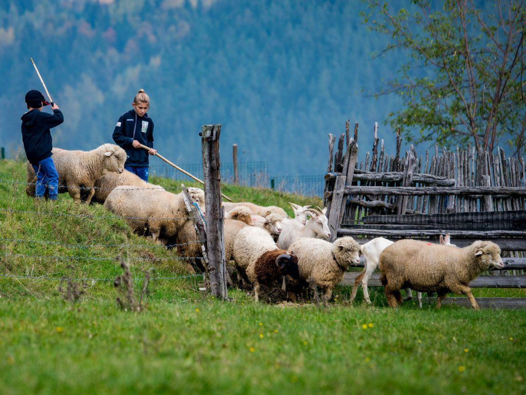
Sheepfolds are a common sight along the Via Transilvanica. In case you meet sheep dogs, dismount and wait for the shepherd. 📸 by Marian Strinoiu
Stage 6. / Piatra Fântânele to Petriș
Immediately after Tășuleasa Social, the asphalt road turns into a gravel road. This is the old Roman Road. It gently climbs toward Zâmbroaia Peak, offering fantastic views of the Bârgău Mountains. The Roman Road slowly disappears, and 4 km after the start, you take a sharp right turn and start descending. You’ll descend for 3 km, passing sheepfolds at first, then holiday homes before reaching DN17.
Cross the main road and immediately turn right. There’s a path running parallel to the road, crossing a couple of streams. Make your way to Mureșenii Bârgăului on this path. The route winds through the village before eventually making its way onto the DN17. As you start seeing the tower of the Orthodox Church, look out for the white building of the Ambulance Service. Turn left off the main road in front of this building. A 1.5 km long climb awaits, followed by a nice long descent into Bistrița Bârgăului.
This section has a lot of tractor roads, so after heavy rain it can get very muddy. A nice, dry alternative is taking the asphalt road from Mureșenii Bârgăului to Colibița Lake and back to Bistrița Bârgăului. The lake is a favorite getaway spot for locals, but has a grim past. When they built the Colibița Dam, the reservoir displaced the old village, and people lost their homes. Legend says that the lake chooses a victim every year from those who swim in it.
From Bistrița Bârgăului, our route heads south, tackling a long 6 km climb on a perfect “Gucci“ gravel road. 10 km of undulating forest roads on the ridge, followed by a 10 km steep asphalt descent, takes you into Petriș. The descent takes you past a nicely arranged sundial and Ceaușescu’s old hunting lodge, which used to have three helipads.
If you fancy a nice glass of wine, Crama Jelna winery is 2 km up the road and open to visitors. Reservations are recommended.
Length: 51 km Elevation: 990 m Duration: 6 hours
Alternative route
The guidebook offers an alternative route for those who wish to visit Bistrița city. The route is identical until Bistrița Bârgăului. From there, you climb the same ascent as on the original route, then, 2 km into the descent, turn right and follow the gravel road into Dorolea.
From Dorolea, follow the main road until you reach a small reservoir lake. Take the dirt road passing the lake from the south (the lake will be on your right). A short, gentle climb takes you to Cocoș Resort. In the winter, it’s a favorite of locals, but in the summer, the ski runs double as downhill bike tracks. We’re going to take one of these track to descend into the city. It’s technical, and treacherous when wet, but the views make up for it.
Bistrița is one of the seven defining cities of Transylvania, with lovely medieval architecture. The main attractions are the Gothic church and the 15th-century fortress. The fortress used to have 18 towers, but only the Coopers’ Tower remains.
Another interesting architectural landmark is the Sugălete Row, the longest Gothic arcade in Transylvania. This complex consists of 13 multistory houses once used by merchants, with rooms for each guild and a unique archway connecting them. Back in the days, they used to sell wheat under the arches, which earned the place its Hungarian name, Búzasor, meaning "wheat row”.
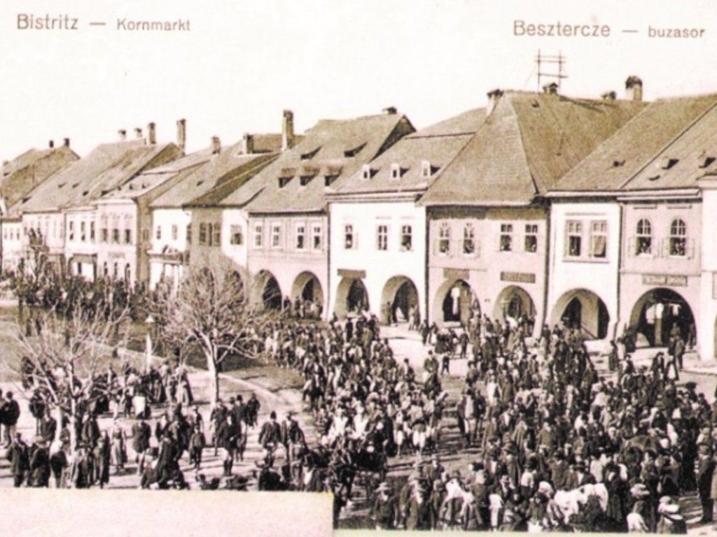
Old postcard showing Bistrița and the Sugălete Row. Unfortunately, it seems these buildings were last restored around the time the postcard was taken, although there are plans for a full restoration in the coming years.
Stage 7. / Petriș to Jeica
From Petriș, the official route takes you to Jelna Winery, and then winds through cornfields back toward Orheiu Bistriței. Unless you are passionate about wine or cornfields, I would suggest taking the asphalt road from Petriș directly to Orheiu Bistriței. Although the guidebook mentions heavy traffic, I never found it to be an issue.
The route leaves the village on a dirt road. Follow it for 1 km, turn right, and cross the asphalt road. Pass a small forest on your left. This forest was planted by the Saxons to provide shade for the livestock. Nowadays, it’s famous for the checkered lilies that bloom in the spring. After the forest, turn slightly left and gently climb until you reach the asphalt road that connects Buduș to Șieu. Turn left onto this road and follow it for 3 km, until you reach a stone cross on your right. Take a right turn here onto the narrow asphalt road. Follow this for another 2 km. There, the asphalt turns left, but we continue straight into the forest and descend into Mărișelu.
As you enter the village, descend to the main road, turn right, then immediately left onto DC15. Follow this road for 7 km until Jeica. Jeica, or Zselyk in Hungarian, is inhabited by a handful of elders, mostly Hungarian. From here on, the Via Transilvanica enters lands predominantly inhabited by Hungarian-speaking people.
Length: 23 km Elevation: 330 m Duration: 3 hours
Alternative route
If you chose to ride through Bistrița, you have to make your way to Mărișelu first, from where the final stretch is the same as the original route. You leave the city by crossing the Podul Berăriei bridge, then climb through Mălinului, Zăvoaie, and Profesor Mircea Călușeriu streets. At the end of the latter, turn right and follow the road until you pass a motocross track. After the track, turn left.
The road will take you through pastures and agricultural fields to Monariu. Cross the village on the main road. Keep your eyes on the electric posts on the left side of the road for a VT sign pointing left. Take this dirt road past the animal shelter, turn left, then right, and cross the river. Keep right after the bridge and climb through the forest, then descend through fields to the main road leading into Domnești. On your left, you will see Râpa cu Păpuși, the “Ravine with Dolls,” a curious sandstone formation.
Take a right turn at the Orthodox Church. Climb 3 km to the top, where you’ll find a VT marker. Turn left onto a dirt road that descends to the outskirts of Mărișelu and the asphalt road toward Jeica.
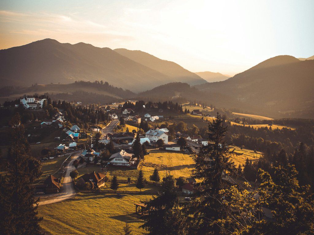
Somewhere in the Bârgău Mountains. 📸 by Andrei Raț
Stage 8. / Jeica to Brâncovenești
Today is dirt-road heaven. Unless it rains, of course, then it quickly becomes a nightmare. In Jeica, you start in front of the church. Pass the church on the left, immediately cross the stream, and head uphill on a nice gravel road. A short 2 km climb will take you to a plateau where the route meanders through forests and pastures before descending into Posmuș. During the descent, you can observe the imposing Teleki Castle from afar. Built in the 1750s in Baroque style, it was destroyed in a fire in 1824, but rebuilt in 1828. During socialism, it fell into disrepair, but was renovated in 2021.
As you reach DJ173, turn left, then immediately right, and follow the grassy dirt road uphill to a forest. Beware, it can get treacherous during the rainy season. Cross the forest and you’ll reach Maria’s Guesthouse. Soon after the guesthouse, you’ll find some wooden crosses on your left. Turn right here, before the bridge. A gentle 5 km climb starts. At the top, there’s a lake where locals often fish. A nice descent takes you into the villages of Monor and Gledin.
In Monor, you can make a short detour to see the mud volcanoes. These fascinating geological formations appear in marshy areas, where underground gases rise through the earth, pushing water and mud to the surface and creating cone-shaped structures that resemble miniature volcanoes.
In Gledin, the official route takes you on a tour of the village, passing the Orthodox Church, crossing a bridge, and then turning right. This takes you back onto the asphalt road. Turn right, then sharply left to cross it. A 2 km climb, followed by a 5 km descent, takes us into Săcalu de Pădure.
Săcalu de Pădure is home to a wooden church, built in 1809. The church stands in the middle of a cemetery that was established in an old orchard. The trail leads you to the church, then backtracks and leaves the village on the last street to the right. A short climb is followed by a refreshing descent on gravel roads into Brâncovenești.
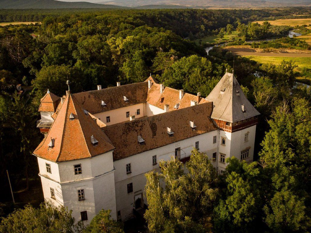
This Hungarian village is home to Kemény Castle, a prime example of Transylvanian Renaissance architecture. Built by the Losonci family in the 15th century, it changed hands several times, finally ending up in the possession of the Kemény family in the 17th century.
During the early 20th century, the castle and its gardens became an important meeting place for Hungarian literary life. Kemény János, the castle’s last resident, founded Helikon, one of Transylvania’s most influential literary and critical journals. The Helikon stone table, a gift from members of the literary circle to the Kemény family, commemorates this legacy. Kemény János and his wife are buried in the garden.
Length: 42 km Elevation: 850 m Duration: 6 hours
The Kemény Castle in Brâncovenești. 📸 by visitmures.com
Stage 9. / Brâncovenești to Brădețelu
The route crosses DN15 just below the castle. Head toward Ideciu de Sus by crossing the Mureș River and the railroad, then turning right. In Ideciu de Sus, turn left in front of the pink building of the village hall. The asphalt road turns into a dirt road as you leave the village and a 2 km climb starts.
At the top you’ll enter a forest and immediately start descending into Deleni. Turn right at the Orthodox church and cross the village. At the other end of the village you’ll see a VT signpost pointing left toward La Poieniță Guesthouse. That’s your cue. Soon you’ll reach another fork in the road with the guesthouse to the right. This time though, you’ll continue straight. The road really starts climbing here for the next 3 km.
You’ll pass by an abandoned farm to your left, then enter a dense forest. As you exit the forest, you’ll find yourself on a tractor road which can get broken up and muddy after heavy rain. Turn right onto this road and follow it 1 km until you pass a shed and hit a muddy crossroads. Turn left and uphill here. After this short, abrupt climb, you cross another dirt road. Continue straight downhill for 2 km until you reach the main road in Adrian.
Cross the main road by turning left and then immediately right and make you way toward the Gurghiu River. Stay next to the river for a while and then cross it over a small wooden suspension bridge. You are now in Gurghiu village, or Görgényszentimre in Hungarian, which owns its fame to the fortress and the Rákóczi-Bornemissza Castle at the foot of the fortress hill. The story of the two are closely interlinked.
This area used to be borderlands and a fortress was built in the 14th century. Nobility, like the Szekler Prefect and the Transylvanian Prince liked spending time at the fortress and hunting in the nearby woods. To make this favorite pastime even more accessible, Rákóczi György I built a renaissance castle at the foot of the hill.
During the rebellion led by Rákóczi Ferenc II, the fortress was completely destroyed and the stones were used to build the small chapel that today sits among the ruins. The castle fell into the hands of the Habsburgs who granted it by decree to the Bornemissza family. The Bornemisszas expanded the castle, added baroque elements and established the English garden with rare plants brought from all over the world. From the end of the 19th century, it operated as a forestry school for over 100 years.
Turn left at the castle and follow the asphalt road into Cașva. Turn right after the Greek Catholic church and then left across the stream toward the Orthodox church. After passing the church, turn right at the first chance onto a gravel road. Gravel quickly turns into dirt. Follow this road uphill until you reach a stream. Don’t cross it, instead head left and continue uphill into the forest.
As you exit the forest, pass the sheepfold on your left, then turn left. Pass through the hamlet of Mirigoaia then turn right and left in a double U-turn toward the top of the hill. From the top, you have a short 2 km descent into Toaca. In the village, turn right for 3 km. At the other end of the village first turn toward Dubiștea de Pădure, then take the gravel road toward the hamlet of Uricea. Follow the gravel road south into Ibănești Pădure. In Ibănești, turn left before crossing the Gughiu River. Follow this street for 6 kms passing the villages of Tisieu, Blidireasa and Zimți. You reach Brădețelu after crossing the river. 1 km after the village you’ll find a mini-resort with several guesthouses.
Length: 41 km Elevation: 1040 m Duration: 6 hours
Bike and equipment selection
For the Highlands section I recommend opting for either a hardtail cross-country mountain bike with 1.9" to 2.25" tires or a gravel bike with 45 mm tires. If you’re a fast rider, a gravel bike will be more fun, but be aware that the route is rocky and technical in places.
Next up: Terra Siculorum
That’s The Highland Region done. We’ve already rolled through plenty of Hungarian villages along the way, and from here the route leans fully into that world. Next up is Terra Siculorum, the land of the Hungarian-speaking Székelys, where the culture gets louder, prouder, and more visible in the day-to-day details.