 by Peter Illés on February 7th, 2026
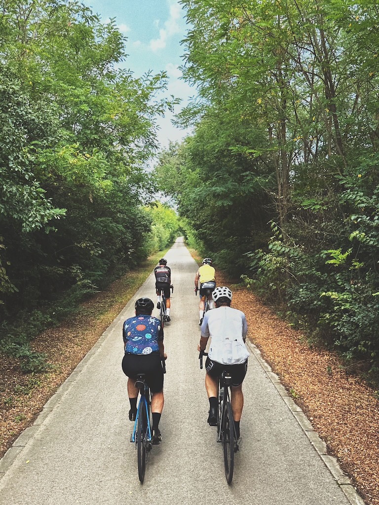
Terra Saxonum is the place where I invite riders to slow their pace. Not because the landscape forces them to, but because it rewards them with the richest stories and the greatest cultural diversity out of all the Via Transilvanica lands.
As you leave Szeklerland and enter Saxon territory at Archita, the change is unmistakable. Suddenly, every village greets you with a fortified church that easily deserves an hour of exploration. The transition is immediate: different architecture, different gates, and different stories held within the walls.
The riding here is steady. Short, abrupt climbs through forests, rolling farmland, quiet backroads linking village to village. Nothing overly technical, but you can expect some sections of push-bike.
In this post I’m following the same structure as in my previous posts, covering the 200 kilometres from Archita to Micăsasa. For each stage, I’ll share trail reports, easier alternatives when you want less gravel, and the highlights worth stopping for.
Stage 14. / Archita to Cloașterf
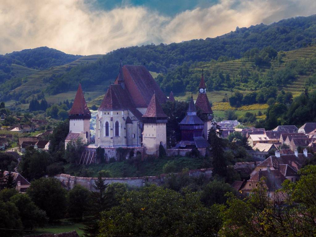
Terra Saxonum opens in Archita, where the white-walled Romanesque church sits in the middle of the village like it has been holding the place together for centuries.
The first climb out of the village is gentle: 4 km at around 5% on soft gravel and grassy track. From there you hop between villages over open hills, field roads, and meadows, with church towers ahead acting like natural waypoints. The next one you’re aiming for is Roadeș, dropping you into Brașov county.
You roll out of Roadeș on tarmac, then almost straight away cut right onto a short bit of singletrack that leads you to the state road. Cross it, and you can take an optional detour to the St. George monastery to top up your water.
From the monastery it gets steeper: a sharp 3.5 km climb through a marshy, technical field. Watch for little stream crossings and wet patches until you reach the next big marker, the asphalt road between Bunești and Viscri. This is where Terra Borza Teutonica splits off.
Turn right on the asphalt and stay on it for about 500 meters, then take a left onto a dirt road with a signpost. There’s another short 2 km climb, followed by a long descent into Criț. Keep an eye out for sheep flocks and their dogs along here.
For centuries, Criț had a built-in support network: the Nachbarschaften. Each one gathered roughly 30 families living close to each other, and the deal was simple: you help your neighbours, and they help you back. From shared farm tools to helping build a new house, the neighborhood had structure, leaders, and rules, and it survived here from 1616 all the way to 1991.
Criț is also the birthplace of businessman Michael Schmidt, who, through his foundation, runs Haferland Week, a festival celebrating the culture and traditions of the Rupea–Saschiz area. It draws thousands of visitors from across the country, and it also brings back several hundred Saxons who emigrated years ago. If you’re into cultural programs, it’s absolutely worth timing your ride to catch it.
In Criț, the main route leaves the village via Prunului Street, turning right just after the last house. Then it’s one last 4 km push up the hill through cow pastures before you enter the forest. After the top, there’s a sneaky left turn a couple hundred meters into the descent, right after you come out of the trees. Miss it and it’s fine. You’ll just end up on my alternative line.
Length: 34 km Elevation: 790 m Duration: 4-5 hours
Alternative route
There’s an alternative line from Criț to Cloașterf that I prefer. In Criț, climb up to the fortified church, then leave the village on the gravel road to the right — Liliacului Street. When the gravel ends you’ll reach a water treatment plant. This is where you hop over a ditch onto a dirt road and keep going.
Stick with that dirt road as it gets narrower and narrower, and eventually feels like it fades into the forest. Don’t stress, you can’t really lose it. Just stay with the valley and follow it uphill through the trees. Pick your line and watch out for twigs and branches.
At the top you’ll pop onto the official route for a few metres. Instead of continuing straight with it, turn right and cross a gorgeous meadow. There isn’t a clear track here, so aim for the far side and pick up the trail again at the other end. From there, follow the dirt tracks down into Cloașterf, entering through the yard of an agricultural business. The gates might be closed, but they’re never locked. Just open them and pass through.
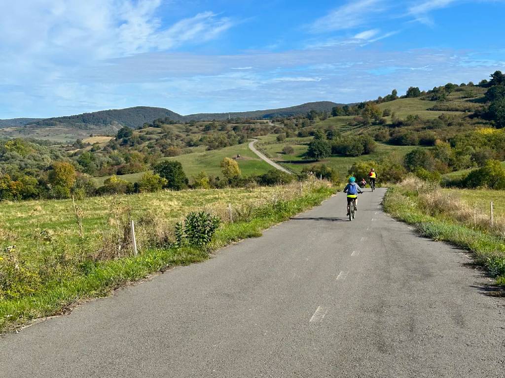
Cyclists on the rolling roads between Cloașterf and Saschiz, on the Via Transilvanica.
Stage 15. / Cloașterf to Sighișoara
You leave Cloașterf on the asphalt road toward Saschiz. It’s mostly used by agricultural machinery, so traffic is light and you can really enjoy the road’s gentle rollers.
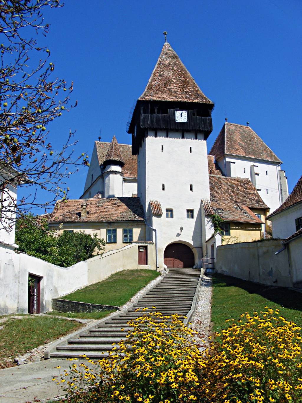
Saschiz is famous for its 15th-century fortified church, a UNESCO World Heritage site, with a neat contrast of styles. Gothic on the outside, Baroque once you step in. Up in the dome there’s also a time capsule from the 1930s: a list of the people involved in the reconstruction, a few coins from the era, and a parchment with a hidden message. It still hasn’t been opened.
If you roll into Saschiz around lunch, try to catch a tasting at Pivnița Bunicii (“Grandma’s Cellar”). They make all kinds of jams, chutneys, and spreads from local produce, served alongside local cheeses, hams, and spirits. It’s one of our favorite stops, and for good reason.
From the church, the Via Transilvanica climbs out of Saschiz on a steep dirt road toward the peasant fortress above the village. Seven nearby villages helped build it so they’d all have a place to retreat in case of attack. It was renovated and reopened in May 2025, and it’s also your last reliable water stop for a while.
From the fortress the trail keeps climbing for another 2 km. Steep enough that you may end up pushing, especially after rain. Eventually it levels out into a wide meadow where several trails meet. Keep that junction in mind: it’s a key landmark for the alternative options too.
The official route then drops sharply through a conifer forest into Daia. Ride through the village, and about 1 km after the exit take a right before the farm. A steady 2 km climb follows, another one that can turn into hike-a-bike in wet conditions. At the top you reach a dirt road scattered with broken brick fragments. From here you can detour to Șapartoc, a quiet village that once had around 800 residents and now has about 25. You’ll hear dogs in the distance, but somehow I’ve never actually run into any.
Back from the detour, you stay on the bricked road. It’s uncomfortable, but there’s a smoother flowtrail about 30 metres to the right that skips the worst of it. When the bricks finally end, look for a table and benches on the right. This is where you enter the forest and pick up one of the best flow trails in the country, weaving through the trees all the way to Sighișoara. As you roll into town, pause to take in the citadel on your left, perched above a sea of red roofs.
Length: 36 km Elevation: 790 m Duration: 4-5 hours
Alternative route
There are plenty of options on this section, especially if you’d rather stay off the dirt as much as possible.
For starters, you can skip the steep dirt climb from Saschiz up to the fortress. There’s a newly paved asphalt road that winds up instead. Follow it up to the fortress, then keep descending straight ahead on the same road toward the village, don’t turn back the way you came. As you roll down, take a right turn that leads you onto the tarmac climb toward the meadow junction.
Another alternative route I prefer taking, avoids both the technical drop into Daia and the push-bike climb back up to the ridge. From the meadow junction, right before the forest, take a right turn (the official Via Transilvanica marker points left toward Daia). At first it’s a cart track that passes through several gates (keep an eye out for the ones with ropes, they’re easy to miss). Little by little it turns into a smooth flow trail that brings you up to the brick road, where you rejoin the official route.
And if you want to avoid flow trails altogether, you can stick with the official descent into Daia, ride out on the road toward Apold, then take DJ106 into Sighișoara. It’s asphalt and usually very low traffic.
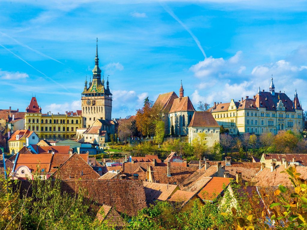
As you roll into Sighișoara, the citadel rises into view above a sea of red rooftops.
Stage 16. / Sighișoara to Mălâncrav
You leave Sighișoara on the road toward Agnita. You’ll spot Via Transilvanica markers on a few utility poles, but they’re not consistent. Before you’re properly out of town, you pass a bus stop, then Vasile Alecsandri Street on the left. Right after that, turn right onto a narrow lane between two houses. It quickly turns into a steep singletrack climbing to the plateau. It requires hike-a-bike even in dry conditions. After rain it can turn into a real grind, and that’s when the alternative route makes more sense.
Up top you reach Breite. The name comes from German and means “the expanse.” This open oak pasture isn’t natural. It was actually created by man, by rarifying the woods here, using the timber for construction and the so-created pasture to feed the animals. They took care to keep the right distance between the trees so they bear as much fruit as possible. Around 690 oaks still remain here, some as old as Sighișoara itself. The biggest one is known as “the Grandpa,” with a trunk about 7 metres across.
Once on the plateau, pass the football field and turn left at the information panels. A gravel road leads for about 6 km into the forest, past logging areas. There’s a Via Transilvanica marker indicating a sharp right turn. What follows is a technical descent into Stejărenii village.
From Stejărenii you cross another ridge, this time on a smooth, ondulating strip of asphalt. In Criș, it’s worth stopping at Bethlen Castle, a 15th–16th century Renaissance build. In 1969, a film crew tried to shoot a siege scene here and set window frames alight for the effect — then couldn’t put it out. Parts of the roof and two wings were damaged, but the castle has since been restored, with some archaeological and restoration work still ongoing.
Back on the bike, descend the short cobbled road from the castle and turn left. The asphalt soon becomes concrete slabs as it goes around a derelict farm, then transforms into a steady dirt climb. It’s sandy and loose, so don’t be surprised if you end up pushing. One of the switchbacks gives you a great view back over Criș, worth a pause.
At the top you hit a wide meadow, then start descending back into the forest. Immediately after the start of the descent, there’s a sharp right turn, don’t miss it. If you do, the other trail still gets you to Mălâncrav, but it’s a much more technical drop where you may be off the bike more than once.
Our trail heads north toward Florești: out of the trees, across a meadow, then through agricultural fields to the asphalt. Turn left on the road and ride through the village. At a fork, take the left-hand option and cross the small wooden bridge.
You leave the village on a gravel road that climbs gently for about 4 km. Then a sharp right drops you into a technical descent down a dried-out creek bed into Mălâncrav. The surface is loose, so take it easy.
Mălâncrav feels cut off from the rest of the world, and that isolation hit hard in the 1990s when many locals lost work. In 2000, the Mihai Eminescu Trust, under the patronage of Prince Charles at the time, stepped in with community projects, house restorations, and re-establishing craft workshops. It’s one of our favorite places to meet artisans on tour.
Mălâncrav is also tied closely to the Apafi family. Not just through their manor which sits high atop a hill, but because the whole village was built on land they owned, rather than on free royal land. In medieval Transylvania it was common for noble families to receive estates through royal donations in return for service and loyalty. The Apafi Manor, built at the end of the 16th century, is the best-known reminder of that. The Apafis also had another manor about 20 km away, and locals still like to tell the story of a secret underground tunnel connecting the two. Never proven, but often retold.
Length: 28 km Elevation: 610 m Duration: 4-5 hours
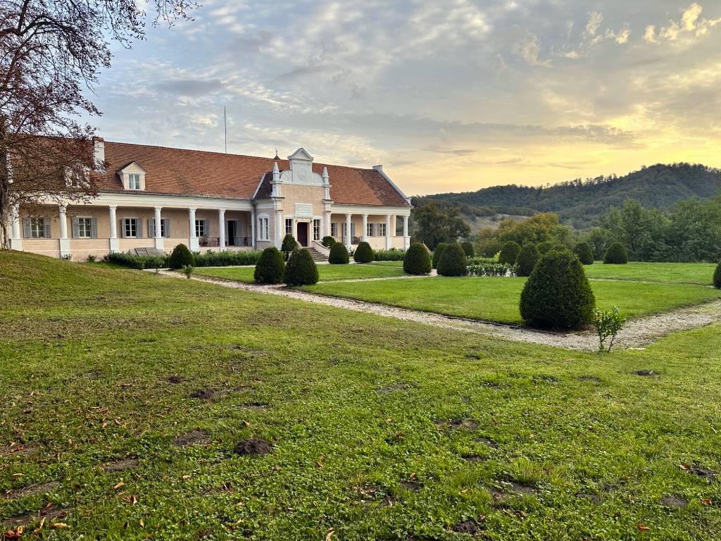
The Apafi Manor in Mălâncrav is a favorite overnight stop on our tours.
Alternative route
In wet weather, I’d strongly suggest skipping the steep push up to the Breite plateau. Instead, leave Sighișoara on the DN14. At the roundabout on the way out of town, keep left toward Mediaș. There’s a short climb, and just after the crest you turn left. From there, a beautifully smooth gravel road takes you through the forest and up onto the plateau. Just keep in mind the first 4–5 km on the DN14 are busy, so ride defensively.
The DN14 is also your easy escape hatch if you want to avoid the ridge crossings altogether. You can drop out to it from Criș, roll a few kilometres on the main road, then duck back into the next valley. There’s plenty of traffic, but the shoulder is wide and I’ve always felt cautiously comfortable there. And if you want to skip the dirt between Florești and Mălâncrav, head north to Laslea, then in the village take the first left and turn back south on asphalt.
Stage 17. / Mălâncrav to Richiș
You kick off the day with a fairly steep 3 km climb out of Mălâncrav, leaving the manor and church straight behind you. The track winds through cow pastures with a few short forest sections before you crest the top. From there it dips through the woods and drops into Nou Săsesc. This entire stretch is characterized by clay surfaces: dusty in summer, slippery in the rain. Either way, traction is always a bit of a fight.
In Nou Săsesc, turn right toward Laslea. About 500 metres after you leave the village, the official route breaks left into a tough 700 m grind, around 10% on loose ground, then rolls down slightly to a rest hut. My suggestion: stay on the asphalt for another 3 km instead, and turn left onto a farm track right after a bridge. It climbs gently and brings you to the same hut without the punchy effort.
From the hut there’s another short climb of about a kilometre as you head out onto open pasture. The official guide says to turn right along the edge of the brushy properties, even though the grassy track continues ahead. I do the opposite: keep going on the grass. It loops around in a U-turn and reconnects with the route, but on a much kinder gradient. You’ll cross several roped gates and bits of electric fencing between pastures, so slow down and pay attention. After that, you get a smooth, gradual descent into Copșa Mare.
In Copșa Mare, you roll past the fortified church and pick up the asphalt that leads to the county road. Cross it, then take the trail on the left side of the bus stop. If you’ve had enough dirt by this point, there’s an easy bailout: turn right on the county road, ride to the end of the village, then take the first left onto the asphalt road toward Biertan.
If you stay with the official route, you’ll join that same Biertan road anyway, then peel left at the Via Transilvanica marker across a meadow and into the forest. A sweet stretch of singletrack follows, opening onto a brilliant viewpoint above Biertan. At the cemetery, take a sharp left and descend toward the fortified church.
Biertan was the seat of the Saxon Lutheran Church from the 16th to the 19th century, which goes a long way to explaining the scale of its UNESCO-listed church. Three concentric walls, seven towers, and two bastions. It’s a proper fortress.
From there, turn right onto the main road and follow it out of town. Take the small asphalt road left toward Dupuș, stay on it until a farm, then turn left onto a dirt road just after the buildings. That starts a steady 4 km climb with a few steeper ramps, paid back with big views over Biertan below. Finally, 5 km of technical descending follows before you reach the asphalt near Richiș.
Length: 26 km Elevation: 690 m Duration: 4 hours
Alternative route
The Mălâncrav–Nou Săsesc stretch is easy to cut short: just head north to Laslea, then in the center of the village turn left right after the bridge. If you want to skip Nou Săsesc to Copșa Mare as well, you’ll need to hop onto the DN14. It’s busy, but the shoulders are wide, so it works if you stay alert. And once you’re in Copșa Mare, you can stay on quiet tarmac all the way to Richiș.
The medieval fortified church in Biertan is the crown-jewel of Transylvanian Gothic architecture.
Stage 18. / Richiș to Bazna
Today is a bit gentler than most of Terra Saxonum, even if it still saves a proper climb for the finale. Start in Richiș with your back to the fortified church. On the left you’ll spot a narrow lane crossing a small bridge. Take it, and a few metres later turn left. Follow that street as it leads you out of the village.
From there it’s a well-marked, rolling 4 km through meadows, farmland, and patches of forest to Nemșa. Head for the fortified church. Right next to it is the Liana guesthouse. Your route runs between the church and the guesthouse, then continues behind it.
Nemșa and Moșna are linked by a stretch of badly broken asphalt. The official Via Transilvanica line keeps roughly parallel a few metres higher on the slope, but honestly it’s simpler to just stay on the road here. In Moșna, the trail zigzags through lanes and backstreets to avoid the main road, though I’ve never found traffic in the village to be a real issue.
Make your way to the medieval church in the center, an excellent example of late Gothic, built on the site of an older church. Local legend says the settlers couldn’t decide where to build, so they released a sparrow; wherever it landed became the spot for the first church, and the Saxon word for sparrow, Mäschn, gave the village its name.
Leaving the church, cross the bridge and take a sharp right. Stay left as you follow the street out of the village until it turns to gravel. The gravel curves gently right, then you’ll need a left turn, and a couple hundred metres later, another left onto an asphalt road. Follow it to a white building (the water treatment plant). Turn right after it, and be ready for a short hike-a-bike.
Next comes about 9 km of rolling dirt tracks above the forests around Mediaș. The route is well marked, and the descent into town is fast, fun, and not overly technical.
Mediaș is one of the seven towns that gave Transylvania its German name, Siebenbürgen (“seven castles”). The standout landmark is the St. Margaret’s Church complex with the Trumpeters’ Tower, a late-Gothic church-fortress dominating the old town, built by the local Saxon community in the 15th century. It’s an easy place to lose a few hours wandering.
From the historic center, the trail crosses the pedestrian bridge over the Târnava Mare and leaves town via Clujului and Wewern streets. On Wewern, look for the spot where the street widens—there’s a marker and a cross—and turn left. A 2 km climb follows at around 7% average. At the top you’ll see vineyards on your left, and then it’s a 5 km descent into Bazna, partly technical, to wrap up the day.
Length: 34 km Elevation: 540 m Duration: 4-5 hours
Alternative route
If by now you’ve had your fill of gravel and dirt, you can simply take the main road from Moșna to Mediaș. There’s some traffic, but it’s generally manageable.
You can also avoid the dirt climbs in and out of Bazna. Instead, follow the roads along the right bank of the Târnava Mare River all the way to the village of Târnava, where you’ll reconnect with the Via Transilvanica on the next stage.
Bazna is famous for its thermal baths, but the fortified church is also worth a visit.
Stage 19. / Bazna to Micăsasa
Bazna is known for its thermal baths, salt water, and therapeutic mud, so it’s a good place to top up and reset before you roll on. You leave town with the spa complex on your left. When the surface turns to gravel, stay right. Switchbacks come quickly, and as you crest the climb and break out of the forest, it’s worth turning around for a wide-open view back across the landscape.
Keep tracing the forest edge until you meet another gravel road, then turn left. You’ll climb for about 4 km before dropping on a long, satisfying descent into Târnava. Ride through the village and follow the right bank of the river toward Copșa Mică. The place is infamous for once being labeled one of Europe’s most polluted towns, due to two major factories, Carbosin (carbon black) and Sometra (a metallurgical smelter), that pumped harmful emissions into the air for decades.
Between Copșa Mică and Axente Sever, you’re forced onto the DN14B national road. Watch out for traffic here.
Axente Sever was originally called Frâua, but today it carries the name of Ioan Axente Sever, a revolutionary figure. He served as a military commander under Avram Iancu, leading Romanian forces in central Transylvania. His name is also associated with the violence in January 1849 at Aiud (Nagyenyed): troops under his command were involved in killings that wiped out a significant share of the town’s Hungarian population, with further deaths during flight in harsh winter conditions. He was later arrested in 1849 and tried over the massacre.
In Axente Sever, turn right onto a dirt road that first crosses the railway, then the Vișa River. From there it follows the river through open agricultural fields toward Agârbiciu. Before you reach the village, you turn away from it and start the final climb of Terra Saxonum, about 3 km, and hike-a-bike is almost guaranteed. The payoff comes at the top: as the path opens, you get a sweeping view over Șeica Mică and the Târnava valley below.
The descent into Șeica Mică is steep, so take it easy. From the church, follow the county road until it meets the national road, where the DN14B makes a U-turn. On the far side of that bend you’ll find a small gravel path with a marker. Take it down to the river, cross the suspension bridge, and roll into Micăsasa, the final settlement of Terra Saxonum.
Length: 40 km Elevation: 620 m Duration: 5 hours
Bike and equipment selection
On Terra Saxonum, I have the most fun riding a gravel bike. I usually run 35 mm tires, but for most riders, 40 mm will feel more forgiving and comfortable. A hardtail MTB works too, but with all the asphalt and fast gravel sections, it can feel a bit slow at times.
Onto Terra Dacica
As you roll on, villages shaped by centuries of German Saxon community life start to fade, and the Via Transilvanica story pivots. Terra Dacica trades towers and churchyards for the bigger Romanian timeline: the modern national chapter around the union story, then further back into the ancient world of Dacia and Rome, where the landmarks stop being defensive walls and start being origins.