 by Peter Illés on February 1st, 2026
The Bucovina section start outside the monastery in Putna. This is Via Transilvanica making a point. Before the climbs and the tracks, you’re given a taste of Bucovina’s best-known story: monasteries, centuries-old frescoes, and a quiet monastic life that feels set apart from everything beyond the gates. You’ll encounter plenty more of it as the days go on, even if the riding was what brought you here in the first place.
Leaving Putna, Via Transilvanica does what it does best: it abandons the obvious route and draws you into the Bukovinian Subcarpathians. A few days roll by smoothly, but most are steep, rough, and quick to turn slippery when it rains. That’s Bucovina by bike. It’s a demanding introduction to the trail. If you make it through here, the other regions will feel noticeably easier.
In this post I’m following the official Via Transilvanica Cyclist’s Guide for Bucovina, from Putna to Poiana Stampei. For each part of the route, I’ll share a surface report, what bike setup makes sense, easier alternatives when conditions turn, and the highlights worth stopping for.
Stage 1. / Putna to Vatra Moldoviței
The trail starts in Putna, one of Moldova’s most important spiritual and cultural centers. The monastery was founded by Stephen the Great and completed in 1469. It feels like the kind of place that sets the tone before you’ve even turned a pedal. Inside the monastery grounds lies Stephen’s tomb, making Putna both a working monastic community and a landmark of national memory. Before the route disappears into forest tracks and hill climbs, you begin here: in frescoed courtyards, ringing bells, and a quiet rhythm that has outlasted centuries.
Leaving Putna, the route heads out on a compacted gravel road that rolls easily for around 11 km, before a steep ramp after a stream crossing forces a first short push-bike section. From there, the trail tops out and drops for a few kilometres toward Sucevița, starting with a more technical descent and then settling into a longer forest road that passes active logging areas, which can turn soft and messy after rain.
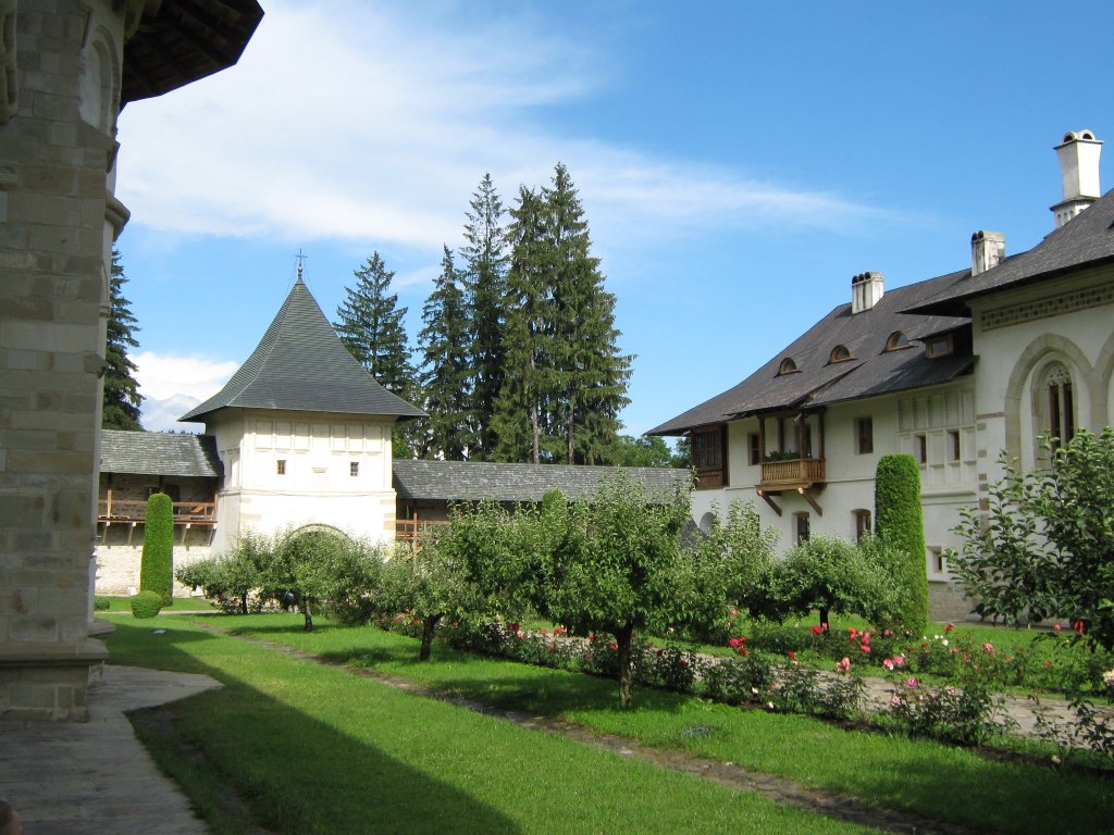
Sucevița Monastery is a UNESCO World Heritage site and one of the painted monasteries that define Bucovina. A major historical monument founded by the Movilă family at the end of the 16th century, known especially for its exterior frescoes and the “Ladder of Virtues” scene.
From the monastery gate the route follows asphalt for about 3 km toward Poiana Mărului, then turns onto a climbing forest road, gradual at first, until the right turn at the barrier marks the start of the harder off-road work.
After the barrier, the route climbs steeply on rough, rocky ground that often becomes push-bike territory. At the top of the climb you already made your way into Hutsul country, a Ukrainian ethnic community encountered in parts of Bucovina. The track then drops again on muddy forest roads, open meadows and pastures, before another short technical climb or push-bike brings you onto the path that eventually tips down into Vatra Moldoviței. The final descent is often slippery when it’s wet, but it opens up views across the valley with the Obcine ridges behind.
In Vatra Moldoviței, Moldovița Monastery is another major Bucovina sight. Founded by Petru Rareș in 1532, its frescoes include themes like the Siege of Constantinople and the Tree of Jesse. Nearby, Lucia Condrea’s Painted Eggs Museum puts a spotlight on the local Hutsul egg-decorating tradition, with a collection of over 11,000 decorated eggs.
If you want something different from churches and climbs, Mocănița Huțulca runs on the old forestry narrow-gauge train line, originally used to haul timber, and today operated occasionally for visitors.
Length: 39 km Elevation: 1170 m Duration: 6-7 hours
Alternative route
If conditions on the forest roads are poor, there’s a road alternative following DN17A between Sucevița and Vatra Moldoviței via the Ciumârna Pass. Sucevița sits directly on DN17A, which makes this a straightforward reroute when needed, with the trade-off being moderate traffic.
Putna Monastery is the burial place of king Stephen the Great.
Stage 2. / Vatra Moldoviței to Fundu Moldovei
From Vatra Moldoviței the track starts with about 5 km of easy, steady gravel climbing until a small hamlet, the kind of place that feels like it’s hanging on to the slope. After that, the riding turns into a 5 km grind up toward Cremenești Peak, where sections are often cut up by water and small streams, so even in a dry spell you should expect some pushing.
Cremenești is an open summit and a clean viewpoint, with the Obcine ridges laid out behind you and Rarău Mountains sitting on the horizon. The route then drops for around 2 km through open fields on a technical descent, where it pays to slow down if there are sheep or cows around, because the dogs usually only relax once the shepherd notices what’s happening. Pro tip: you can always buy fresh milk and cheese from the shepherds.
That descent is followed by a short, steep push back up to Pietriș Peak, the highest point of the Via Transilvanica. From there you get about 7 km of descent, with the first kilometre often being the awkward one where you’re on and off the bike, before it turns into a smoother gravel line past Iezer Lake as you drop into Sadova.
Iezer Lake is one of those spots where the landscape comes with a story attached. Locals talk about a treasure hidden by the Tatars, and these days you can even zipline over the water, which makes for a strange contrast with how quiet the place still feels from the shore.
Out of Sadova the route kicks up for around 4 km on a mix of mud and rock, but it’s still rideable. At the top, the official track drops right down a steep, rocky descent that’s usually an awkward walk. For a fully rideable option, take the left turn instead. It seems like a bad choice for the first few hundred meters, but then it opens up into a fun gravel descent. Use the GPX at the end of the post because that’s the line I include there.
Fundu Moldovei, your stay for the night, is one of those Bucovina villages where traditions still show up in everyday life. If you land here around New Year, you will hear groups of kids going house to house with wishes and masked dances with characters like the goat, bear, and deer, often accompanied by whips, bells, and flutes. Families welcome these groups with food and coins, as the traditions celebrate renewal, fertility, and prosperity.
New Year’s is also a time for forecasting the months ahead, using symbolic “calendars” made from onion skins or embers to predict rain and crop yields. On January 1st, children return to scatter grains in homes for good luck, while the loud buhai is meant to drive away the previous year’s misfortune.
Length: 29 km Elevation: 1100 m Duration: 6-7 hours
Alternative route
This is likely the most demanding stage on the entire Via Transilvanica. Choosing the DN17A is a perfectly reasonable alternative, particularly when the weather turns bad. If you want to shorten the distance while staying partly off the main road, follow the Cremenești forest road until you cross the Vulcan stream, then turn immediately left toward the village of Paltinu. You can rejoin the main road there.
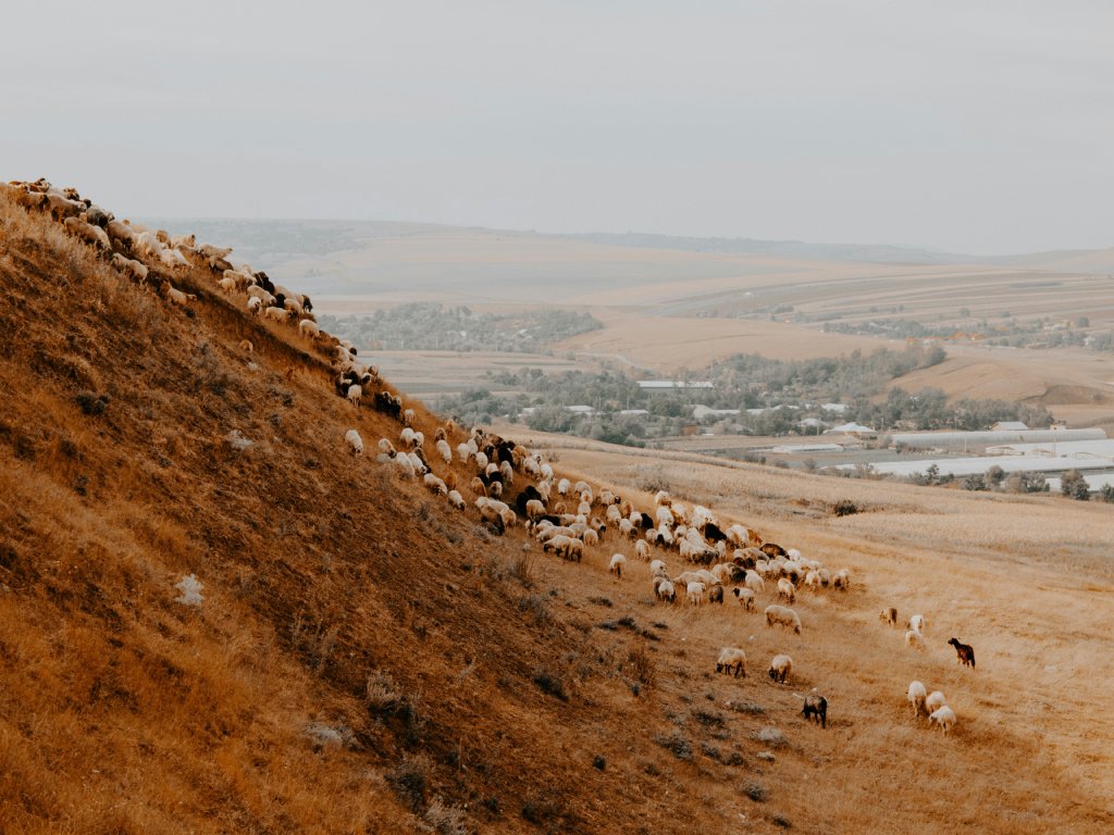
Wait for the shepherd if you happen to run into a flock of sheep. 📸 by Vlad Sargu
Stage 3. / Fundu Moldovei to Vatra Dornei
After the first two stages, this one usually feels easy! The day begins with about 2 km of flat warm-up, then a 9 km ascent toward Mestecăniș Peak on compacted dirt roads that let you settle into a steady pace. A short 2 km descent drops you onto the Mestecăniș Pass and the DN17, where there’s a restaurant if you need to top up before heading back onto quieter lanes.
From the pass, the route turns into a long, gentle climb of roughly 16 km, passing Mănăstirea Mestecăniș, a small Orthodox monastic community dedicated to Saint Pantelimon, tucked above the main road in the Giumalău area. Not far after, Cabana Gigi Ursu is a handy water stop before the final run-in.
The stage finishes with about 5 km of descent into Vatra Dornei, generally not technical, but with a few gates that need opening and closing as you cross pastureland. Vatra Dornei grew into a spa town under Habsburg rule, and while much of that old resort gloss has faded, the bones are still there, especially around the park and the historic casino building.
Length: 36 km Elevation: 980 m Duration: 5-6 hours
Stage 4. / Vatra Dornei to Poiana Stampei
The day starts with a steep 5 km grind straight under the ski lifts as you climb to the ski station above Vatra Dornei. If you want to skip that climb, the chairlift is a workable alternative, and it gets you to the same high ground without burning the legs before the rest of the route.
Once you’re up on the plateau, there are about 3 km of easier riding before a sharp right turn tips you into a long, clean descent of roughly 7 km down to Dorna Candrenilor. Dorna Candrenilor is tied to mineral water and spa culture: the La Burcuț springs were already used for treatments by 1898, the resort burned in 1937, and the “spa town” story never really recovered, even if the waters still live on through bottling in the area. The village architecture stands out too, with lots of wooden houses and exterior decorations in floral and geometric patterns.
From Dorna Candrenilor there’s a gentle 6 km rise toward Poiana Negrii, passing several gates. From here, the route crosses the ridge toward Poiana Stampei on a steep but rideable gravel road. It feels like a proper ridge crossing, but there are some sheepfolds up top, so beware of dogs. The trail finally drops and settles as you roll into Poiana Stampei to close the Bucovina chapter.
But before you do, you may want to make a quick detour from Poiana Stampei to the Tinovul Mare peat bog. This is the country’s largest peat bog, where you can observe a unique ecosystem formed by organically rich soil that decomposes extremely slowly due to the lack of oxygen.
Length: 29 km Elevation: 940 m Duration: 5-6 hours
Alternative route
From Vatra Dornei you can skip the ski-station climb (and the high views) by staying on the main road straight to Dorna Candrenilor. That shortens the day a lot and opens the option of linking it into the previous stage.
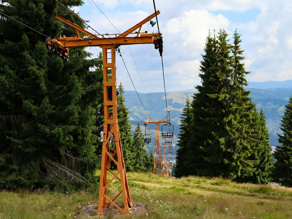
The trail heads out of Vatra Dornei under the ski lifts. 📸 by fermoar.ro
Bike and equipment selection
For the Bucovina section I recommend opting for a hardtail cross-country mountain bike with 1.9" to 2.25" tires. If you’re a more technical rider, a gravel bike with at least 40 mm tires can be a blast too, especially in the dry season. Pack light: there are plenty of hike-a-bike stretches, and extra bags or panniers will only slow you down.
Leaving Bucovina
That’s Bucovina done. Once you roll into Poiana Stampei, the route changes tone: the next chapter, Ținutul de Sus, feels less like wrestling the terrain and more like settling into the long rhythm of Via Transilvanica, with days that link villages and valleys more predictably. If you want to ride my Stage 2 descent variant (and keep your navigation clean), grab the GPX below.